Climate Change Resilience Modeling
We develop custom solutions for predictive modeling, database management, and web application development in the area of climate change resilience including analysis of extreme weather events, erosion mitigation, agricultural conservation practices, and resilience of transportation infrastructure to flooding. Our tools help stakeholders make decisions related to climate change based on the best available models and data. We connect clients to rich data through accessible, interactive, user friendly web applications.
Examples of our work include:
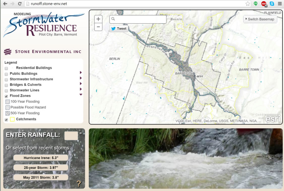
- The maps predictions of changes in runoff due to extreme rainfall events in relation to culverts, bridges, roads, emergency buildings, and FEMA flood maps for five catchments in Barre, Vermont.
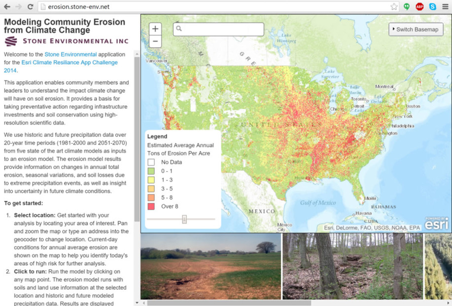
- The calculates predictions of seasonal variability in soil erosion under current and future climate conditions based on downscaled precipitation data from five global climate models.
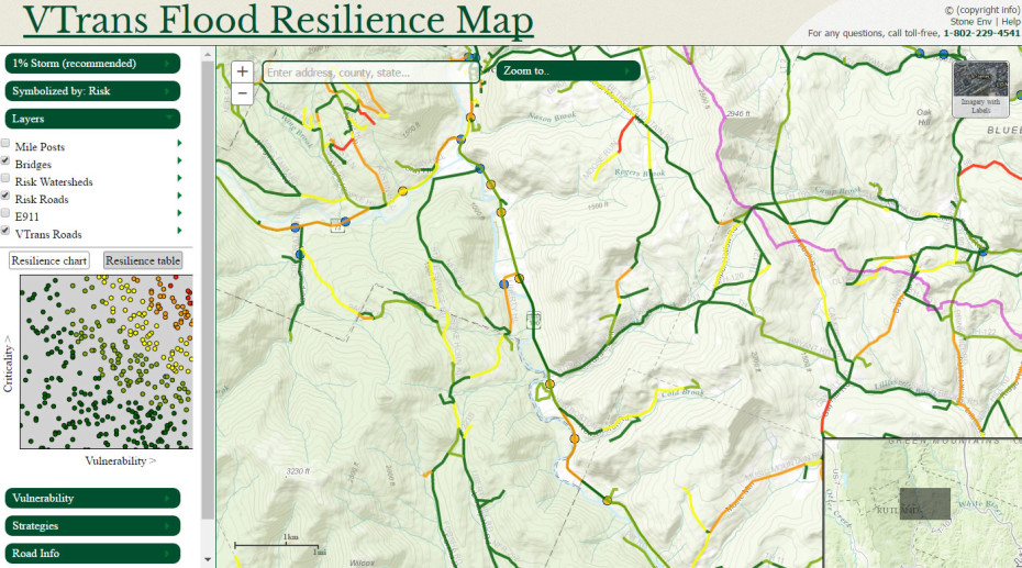
- The Vermont Transportation Flood Resilience App helps transportation planners identify roads, bridges, and culverts with a high risk of disruption due to flood threats. This flood risk information informs prioritization and planning of future projects.
- The allows state and federal agencies, including NRCS and AAFM, to share information on agricultural conservation practice implementation status.
- The interfaces with the APEX agricultural model, enabling NRCS and Agency of Agriculture staff in Vermont to work with farm scale conservation plan information and analyze alternative conservation practices and management scenarios by executing the sophisticated APEX model on the back end, concurrently providing analyses to inform climate change impacts on environmental quality.